As you may already know, or read in our article “Geofences: What Are They & Why Should You Care?”, a geofence is a virtual boundary, set up around a specific location. Utilizing geofences, contractors and material producers can define a perimeter around a job site, quarry, plant or dumpsite.
Cycle Time Analytics Boosts Headway for Contractors and Material Producers
So, why does this matter? Some of the benefits of using geofences to capture enter and exit events at a job site, quarry, plant or dumpsite include:
- Identifying delays
- Identifying high performing locations and creating best practices
- Scheduling smarter
- Using data to improve performance
Creating Your Geofence Best Practices
If you want to create an effective geofence, here are some of our top recommendations:
- Be sure to cover the entire worksite.
- Exclude nearby roads.
- Don’t set your geofence boundary where your trucks to enter or exit the job site.
TRUX Creates Efficient Cycle Time Reporting
Here’s how we take that data from the geofence to the next level:
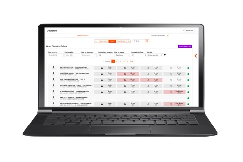
Cycle time reporting tracks each event of the trucker's cycle from when they start to when they complete each load. With the push of a button, dispatchers can instantly:
- Identify bottlenecks in order deliveries
- Discover trucking congestion at job sites and/or plants before it becomes problematic
- Determine if a job is over or under trucked

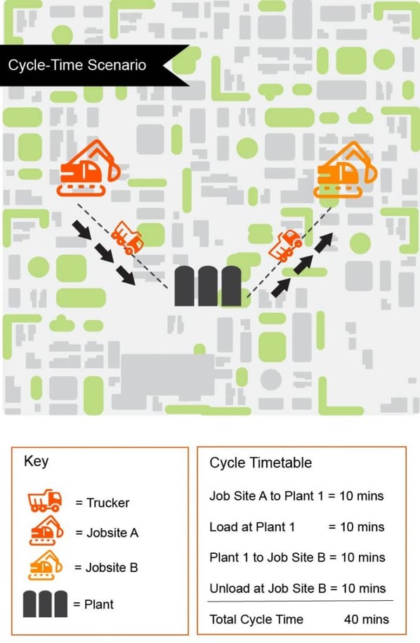
Take this example: if a truck starts its first leg from Job Site A to Plant 1 and then to Job Site B, and each leg takes approximately 10 minutes, including loads and unloads, the total cycle time is 40 minutes.
Every leg of a cycle time has a benchmark. On average, most legs, like loading at a quarry, run between 10-15 minutes.
In addition, cycle time reporting allows us to take traffic conditions into consideration, which means more accurate cycle time analysis.

Cycle Time Report
Interested in learning more about cycle time analytics? Check out our TRUX Insights video on Cycle Time Reporting featuring TRUX Business Analyst Matt Hennessy:
Watch Video
Targeting Efficient Times Through GPS Tracking
When material producers and contractors are creating bids and building quotes for projects, they often agree on standards for trucking turnaround times at the job sites and quarries. These times are used as a way to forecast trucking costs throughout a project.
Currently, accountability is held through anecdotal stories. With GPS tracking, all parties have a transparent view of each part of the cycle time. No pointing fingers as to why a job didn’t get done on time.
TRUX Brings Real-Time Reporting to the Construction Industry
With the help of geofences, cycle time calculator and reporting, and GPS tracking, contractors, construction companies, and material producers will have the tools to optimize decision making in real-time. All these tools help streamline the project delivery process and puts all participants of the dump truck ecosystem into perspective. Every aspect of project delivery or material producing business can be backed by the power of data.


